Monday, April 30, 2012

4/30/12 East Fork Mission Creek Road, mile 225.5

(Sent as a phone text, the evening after the early morning phone call!)

I had a nice breakfast with Ziggy and the Bear at their hostel. 

Took a picture of the view back towards the San Jacinto Mts. while hiking into the San Gorgonio Wilderness. It has been a warm day, and I’m a bit gimpy from the blisters on my feet.

The landscape reminds me of the John Day area in eastern Oregon - the lay of the land, weird colored rocks, and volcanic ash deposits. I saw yet another rattlesnake. 

Tonight I’m sleeping by a gurgling creek with frogs, bats, and a silvery half moon for a night light.
-JayBird

4/30/12 Somewhere north of Fuller Ridge, mile ???

From Sarah, via short phone conversation with Jay in early morning before her work:

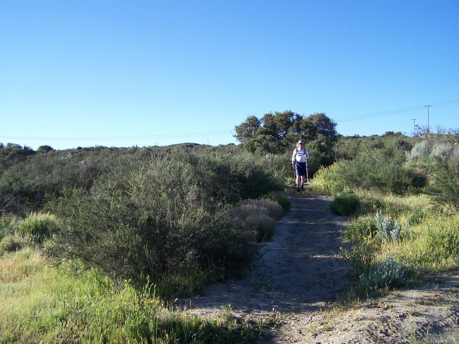
Jay called to say he had been hiking through some very rough country, with no phone coverage and very little phone battery. (The guidebook mentions that the trail through the San Jacinto Mts. frequently had to be dynamited in order to build it on such steep slopes, and calls the trail down Fuller Ridge “torturous”.) Jay said there was a lot of snow across Fuller Ridge, and the trail was virtually impossible to find several times. Thanks to his maps, he knew the general direction, but found it extremely difficult to stay on the trail. It was a long, frustrating day.

After 25 miles on Sunday, he came to a road and decided to hitchhike to the nearest town. Someone at the trailhead told him the nearest town had no services, and he should hitch hike into Palm Springs instead. Just as he was trying to hitch hike the much longer route, a car pulled up with two local hikers. They took him to the nearest grocery store, waited while he shopped, then took him to The Bear’s PCT Hikers’ Oasis, a hostel hosted by two trail angels, Bear and Ziggy. It is those ‘coincidences’ that reassure me God is watching over Jay!

What a relief, eat something besides trail food, sleep with no worries about a collapsing tent, and (most importantly) connect with loved ones again! Jay said Bear and Ziggy were wonderful hosts, providing exactly what every exhausted hiker needed.

Jay was a little vague in the phone call as to exactly where he is on the trail right now. But it is enough for me to know that he is okay and now has a fully recharged phone! I’m sure he will be sending more news in the coming days.
-Sarah

Sunday, April 29, 2012

4/29/12 Trail Angel’s Place (aka The Bear’s PCT Hikers’ Oasis), left trail at Cottonwood Rd, mile 211, 23.5 miles


(Sent as phone text. Received by Sarah May 2 due to the mysteries and vagaries of patchy cell phone coverage. More added from journal when Sarah met Jay on May 5.)

The morning dawned still and calm. My shoes were frozen, but my water bottle was not, fortunately. The snow was frozen so hard I could almost skate upon it. Not very reassuring on steep ground while carrying a heavy pack! I used crampons to descend to about 7,000 ft, then was able to continue on dry trail.

I had a long descent to I-10 at 1,198 feet elevation with fifteen miles between water sources. Got really lucky and met a guy who drove me to Albertsons, 14 miles, then back to a trail angel’s place.  

This is a wonderful place where I’m staying. Amenities include foot bath, salad, ice cream. I’m treating blisters on my left heel and right big toe, and meeting many nice people.

Saturday, April 28, 2012

4/28/12 Castle Rocks, mile 187.5, 16.5 miles

My phone battery is totally dead, so no pictures and no GPS.

It was 40˚F at 7:30 a.m.  Lots of snow on the trail today.  I used the crampons and ice axe a good bit.  I found it exhausting to go uphill in crampons, but there were places where the trail was totally covered with snow.  Most of the time I followed other people’s tracks, using my map to verify that the tracks were heading in the right direction.  The map gave me confidence in my location, the tracks gave me confidence that someone else had already made it through.  At one point I was down to following one set of tracks.  Then I met the guy who had been making the tracks, coming back toward me.  “I just can’t find the trail,” he told me, and went on backtracking.  So with unbroken snow ahead, I used the topo map and finally did find the trail.  What a relief. 

I camped at 8,500 feet altitude at 6:30 p.m..  I couldn’t have made it through today without the help of other people's tracks.

Friday, April 27, 2012

4/27/12 In the San Jacinto Mts., mile 171, 20 miles

It was a clear, breezy, cool day.  Long ascents to Fuller Ridge.  I felt the altitude on the first climb.  Trail dropped and climbed back up 1300 feet.  Then had to walk a half mile son a side trail to Apache Springs for water.  500 feet down, then 500 feet back up in each half mile.

I crossed an area with steep snow chutes, but did not need the ice axe or crampons.  I only saw two SOBO (south bound) section hikers today.  Camped with tent perched on a bluff above Palm Springs .

Thursday, April 26, 2012

4/26/12 Hwy. 74, (Pines to Palms Hwy. ), mile 151

(sent as phone text)


At 2 a.m. my tent collapsed during a storm.  The door half of the tent was soaked, puddles of standing water on it.  I was left to spend the night curled into the foot end, wind buffeting my body, needing to pee, but unwilling to get soaked crawling through collapsed tent. 

It was 40˚F when I got up at dawn.  Wind and rain still my companions.  I threw everything into my pack and hiked downhill for an hour, getting off the mountain and out of the storm.  Took a picture of my drying gear when I finally stopped. 
At Hwy 74, there is a cafe with fantastic pie about a mile down the road. Had to skip it due to timing of the day. 

There has been virtually no phone coverage for the last two days. My phone battery is very low.

Today I had a long climb upward toward the San Jacinto Mountains. Found buried treasure right where I had left it. Arrrrgh!

Weather clearing.
-JayBird 

(Note from Sarah:  A week ago, on our way to the PCT trailhead, we stopped near Hwy. 74 and buried Jay’s ice axe. That's the treasure he is referencing. He may well need it in the San Jacinto Mts., especially on Fuller Ridge, but he had no desire to carry it the first 150 miles through the desert!)

Wednesday, April 25, 2012

4/25/12 past Trail Angel Mike’s, mile 128, 19.0 miles hiked

Packing gear (Lake Morena). Obviously a well-organized
packer! I don't know, this looks like way more than 30 lbs.
Hmmm, wonder what to leave behind?? (Just kidding!)
Before leaving home, I mailed a re-supply box to Warm Springs, as the guidebook said that the resort there had closed. So this morning I found the post office in Warm Springs, re-supplied my pack, and got out at 9:00 a.m.

I thought I’d take a short cut back to the PCT, but it didn’t work out so well. Ended up cutting through a golf course, climbing fences, skirting beehives, crossing a private campground, and wading a brush-choked creek before finally regaining the PCT.

One day's worth of food for a no-cook thru-hiker.
Very soon after returning to the well-marked, easily-followed track, (as opposed to beating the bushes through a non-existent shortcut), I decided to go ahead and eat one of the treats I had mailed in my resupply box. A shady creek called Agua Calliente was the perfect place to rest and consume a 16 ounce salami with Ritz crackers. Lightened my pack a bit, too!

I hiked through beige boulders, blooming white and purple ceonothus, oaks, and Coulter pines with huge cones. A snake lay across the trail, torpid in the cool temperatures. I nudged him with my pole and he just stuck his tongue out at me. There were also many large black lizards.

My right foot developed an ache across the top of the arch. Finally used duct tape to reinforce the bottom of the insole arch, and that fixed it.

Black-crowned Night Heron. Two Herons guarded their
territory from the ravens. These don't get their black crowns
their 3rd year, so this one was 1-2 years old.
Wind, fog, steep terrain became my companions as evening progressed. I finally pitched my tent on a tiny flat spot. I pitched the small, foot end of the tent into the wind, making it aerodynamic. This gave me the choice of sleeping with my head on the downhill slope, or cramming my head and shoulders into the foot end of the tent to sleep with head uphill. I chose uphill.

Tuesday, April 24, 2012

4/24/12 Cañada Verde Creek, (Spanish for green ravine), mile 109, 23 miles hiked

Jay hikes by a ceanothus shrub in full bloom.
Last year I carried our two person tent the whole of the Appalachian Trail, and was sometimes teased by other hikers about the ‘palace’ I slept in. Whenever it rained, though, I enjoyed the luxury of dry space. This year I decided to invest in a single person tent. Hiking in a dryer climate and keeping my pack light were the major reasons for the switch.

However, I’m still learning how to set up my single person tent. Last night a big wind came up and my tent promptly collapsed, with me inside. I was too tired to get up and fix it, so slept with flapping nylon all around me. Next time I will set up the tent with the smaller foot end pointing into the wind, to make it more aerodynamic. I took a picture of it this morning, after wriggling out.

Huge boulders along the trail. This one looks like a giant owl!
At mile 91 I took a picture of a water cache 14 miles after the previous one, and I took a picture of some yuccas. (Note from Sarah – I think this might be the water cache stocked by volunteers of the Sierra Club’s San Diego Chapter. The guidebook says it consists of 55 gallons of water secured by a nylon cord. Imagine packing in that much water! This section of the PCT would be incredibly hard without volunteers to maintain trail and water caches.)

Today I crested the San Felipe Hills, then took a long, winding descent, across a piece of prairie, where I took another picture. The trail then led down along a creek. I was just about to indulge in a bath when cows waded by. Plop, plop. Oh well.

Drinking 3 cups of cold oatmeal for breakfast (Lake Morena
campground). Mmmmm.... cold oatmeal in chilly temps. Not
the best combo, but it will stick with ya for a while!
It was cooler with thin overcast today. Another great day to be outdoors.
-JayBird

Monday, April 23, 2012

4/23/12 Past Scissors Crossing, mile 86, 24 miles hiked

Stopping in a sparse patch of shade for a rest and snack.
Incredibly gentle gradients have made elevation gain and loss almost unnoticeable today, except that one can’t help noticing the fantastic views. I enjoy seeing for miles ahead and behind me, watching the trail undulate along mountainsides, around the heads of gullies, across valleys.

This morning my first order of business was to pack up and head for water. I found that wonderful life-saving liquid just 6.5 miles down the trail on Rodriguez Spur Truck Trail. Fortified with water and breakfast, I continued on, following a circuitous route as the PCT wound around private land, working at staying on public land. After all that winding around, it was quite a contrast to cross the northern part of Earthquake Valley on an arrow-straight trail.

Jay chats with another thru-hiker resting in the shade. Hiking
in the morning and evening and resting mid-day is a smart
idea in the dry heat here.
On my way to a water cache at Scissors Crossing, I passed through a beautiful hidden garden. Yuccas pointed tall stalks to the sky, covered with whitish-purplish globe-like blossoms. Clusters of prickly pear sprouted pink blossoms near my feet, and every barrel cactus wore a crown of yellow blossoms. In this spiny garden I met a horned toad who graciously posed for several pictures.

I also saw two rattlesnakes today. One was in the classic pose, head up, tail coiled, raised rattle buzzing wildly. Took a picture.

After replenishing water, I began a gradual climb into the San Felipe Hills. Bizarre ocotillo stems, standing 10 – 15 feet tall, sported delicate green leaves and red blossoms. I found a very nice campsite, all alone. Although it is a dry camp, I have enough water for dinner and breakfast, before continuing in the morning. 

Once again, I am feeling fine after a day of hiking, meeting interesting people, seeing spectacular scenery, and just living outdoors.
-JayBird

Long view of Hauser Canyon. Note Barrett Lake in the distance.


Sunday, April 22, 2012

4/22/12 Dry Fire Tank, mile 62.0, 21 miles hiked

At the beginning of the trail with Border Patrol in the background.

Thinking I would fill my water bottles at a fire tank on the trail, I stupidly passed a water source and paid for it by sending myself to bed with no dinner (or water) when I found the tank dry. I took a picture of Steve’s tent and the dry fire tank.

I have met a lot of nice people.


Border Patrol interviewing hikers
at the beginning of the trail.

Today I enjoyed hiking down out of the Laguna Mountains with sweeping views of hecka-arid country to the east. The Laguna Mountains are a classic example of rainy lush growth (at least in April) on the west side, rain-shadow arid desert on the east side.
-JayBird

Saturday, April 21, 2012

4/21/12 Burnt Rancheria Campground, mile 41.5, 21 miles hiked


He's really on his way! Wait, THIS doesn't look like mountains.
Why isn't the trail headed UP? What does that sign say?
City Park?!
Oh, no..... I guess it IS the PCT! Go for it, Jay!
I saw a turkey vulture roost today and lots of rabbits. I climbed through chaparral to the Laguna Mountains, an ascent of 3,000 feet over about 10 miles. It was a warm day, but the forest in the mountains was much cooler. All the creeks are flowing at this time, so there is plenty of water.

I had a close call with a cryptic silent rattler. As heart-stopping as their rattling sound is, I’d rather get the adrenaline rush from the sound than from the sight of a silent rattler too close for comfort!

I hiked the 21 miles in 10 hours today. Drank 7 liters of water and am feeling fine.
-JayBird

Friday, April 20, 2012

4/20/2012 Lake Morena Campground, mile 20.5, hiked 20.5 miles

Sunscreen here is a must! Jay applies it before his first day -
his 20 mile slackpack back to Lake Morena.
It was a sunny day with temperatures of 56ºF at 7:30 a.m., 85ºF at  I was surprised at the lushness of the vegetation. Lots of green grass, tall shrubs, flowers made a green landscape with outcrops of gray granite. I felt as if I were strolling through Eden – complete with the snake! Luckily the rattler gave me warning with six inches of hissing head and fangs swaying over coiled, buzzing tail. After a few tense moments, he agreed to lay down and let me photograph him. There were also many birds: turkey vultures, acorn woodpeckers, ravens, mourning doves, quail and many others. 

Lake Morena from the trail


 Thanks to Sarah, I was able to hike light today, carrying 11 pounds of water, 2.5 pounds of food, and perhaps 6 pounds of equipment. She kept tent, sleeping bag, etc. at Lake Morena Campground, 20 miles from the start of the PCT while I hiked with light heart and nearly empty pack. 


Jay at Hauser Creek, where he met Sarah
for lunch on Day 1. 


Today I hiked all of the distance at once because I was eager to reach Sarah at the campground. She surprised me at Hauser Canyon, and we were able to hike together for the last 4 miles. It will make more sense, as the weather gets hotter, for me to sit out the mid-day heat and make miles during the late afternoon and early evening. 

That’s all for now. More soon.
-JayBird


Morena Butte on the left and the trail dropping into Hauser Canyon


Wednesday, April 18, 2012

Itinerary

Sarah and Jay at PCT Monument - border fence in the
background. Jay is geared up and ready to hike!
Here is my best estimate of my hiking schedule for those who wish to mail me things:

Location          Date
California        Spring
Oregon           Summer
Washington     Fall

Monday, April 16, 2012

Intro

The Sierra Nevada Mountains, as seen from Lone Pine, CA. Jay will hike
through these in June. He's hoping more of that snow is melted by then.
Hello. My name is Jay Bigelow. I am 52 years old. My sister-in-law, Helen, has graciously agreed to maintain this blog for me. This blog is about my intended thru-hike of the Pacific Crest Trail in 2012. I will begin my journey on the Mexican border about 48 miles east of San Diego on Friday, April 20. Hopefully, I will finish the 2,654-mile hike at Manning Provincial Park in Canada some time before October. I will carry an android and solar charger, so I intend to submit daily entries for this blog. The postings will probably occur in groups whenever I get coverage. I will make an effort to provide a daily picture, and a brief synopsis of each day's events.

Jay getting ready to hike the PCT.
He's standing next to the beginning marker,
Mexico/USA border fence behind him.

I completed a thru-hike of the Appalachian Trail last year (2011). Helen created and maintained a blog for that hike at www.JayBigelowAppalachianTrail2011.blogspot.com . I have been training intensively for the PCT hike since I returned home last September, hiking for 4 hours each day on a steep hill near my house carrying 40 lbs. I expect to carry an average of 24 pounds on the trip. My wife, Sarah, will join me for 8 weeks during her summer vacation. I plan to hike fast until she joins me in early June, and then slow down a little. My start date precedes the annual kickoff party for PCT thru-hikers by one week. Southern California offers several mountain ranges separated by hot, arid valleys.  Start too early and you risk facing deep snow. Start too late, and the water sources in the lowlands dry up. I am hoping that with this year's relatively low snow pack, my start date will present a tolerable compromise between those issues.

Beginning the PCT