7/17/2012, Parks Creek trailhead, mile 1,545.5, 32.0 miles traveled.
Sarah dropped me back at the Dog trailhead, where I began a spectacular 5,000-ft. ascent through the crags and to the Trinity Divide. The weather was damp and cool, about 44˚F, and overhanging vegetation kept my feet and legs soaking wet all day. I had to keep my breaks short because I didn’t have enough clothing to stay warm unless I was walking. The ridge I was on became enveloped in mist, and it rained off and on for most of the afternoon. After I met Sarah at Porcupine Lake, the clouds began to lift and we enjoyed spectacular views. We decided to push for the car at Parks Creek and book a hotel in Weed for a zero rather than spend a long cold night forecast to be in the 30’s and taking a nero the next day.

Climbing through Castle Crags State Park.

Saprophytes? Castle Crags Wilderness.

Toad Lake on the Trinity Divide.

Mt. Shasta from the Trinity Divide.

Lower Deadfall Lake, Trinity Divide.
7/16/2012, Dog Trail junction, mile 1,513.5, 23.5 miles traveled.
It was nice and cool today. The trail was easy, with a morning climb over the Girard Ridge and a long descent into the Interstate-5 corridor. I had a kind of epiphany during the morning concerning my motives for hiking the PCT. I had been kind of caught up in the “show everyone how tough you are” attitude even though I tried not to be. When Sarah started bringing me food on the trail, some of the other hikers insinuated I was cheating. One joked that there should be an asterisk next to my name on the thru-hikers register stating I had received assistance. During this morning, I thought of all the ways a modern thru-hiker is assisted: maintained trails, maps, GPS, guidebooks, modern medicine, Deet, emergency evacuations, shoes and clothing, light-weight equipment, towns near the trail, weather forecasts, trail angels, lack of grizzly bears and outlaws, water treatment....and much more. I cannot aspire to the toughness of, say, the members of the Lewis and Clark expedition, most of who were barefoot and took doses of mercury to treat venereal disease. My hike is not a race. I am not an aspiring athlete. Most anyone can hike this trail if they want to badly enough. My purpose is to see what remains of our wild places on foot. As long as I walk the trail, I will consider any other assistance a blessing. I am indeed fortunate to have a wife who is willing to hike sandwiches in to me! Well anyway, I was happy to meet Sarah in Castle Crags State Park. She took me and a few other hikers into Dunsmuir, where I had a wonderful hamburger and two blackberry milkshakes. We camped back at the park, and had a nice evening with Crow, Dude, Reststop, Wasabi, and Viper.

Castle Crags State Park and the Trinity Divide from the Girard Ridge.

Lavender tiger lilies?

Castle Crags State Park.

Sulfur Creek, Castle Crags State Park.
7/15/2012, Squaw Creek, mile 1,490.0, 26.0 miles traveled.
Today the trail continued along ridge lines, repeatedly descending into oak woodlands, and climbing back into pine forests. I prefer the mosquitoes in the pines to the gnats in the oaks, because the mosquitoes don’t usually bother me while I’m walking. The gnats, on the other hand, seemed to be attracted to movement, and seemed determined to land in my eyes. I enjoyed crossing the McCloud River, once home to the unique Winter Run Chinook Salmon whose eggs incubated during the summer. Springs gushing from canyon walls created conditions suitable for egg incubation throughout the summer when other western rivers were too warm. Too bad they built Shasta Dam without a fish ladder.

McCloud River.

Ash Camp resident desires peanut butter.
7/14/2012, Gold Creek, mile 1,464.0, 27.5 miles traveled.
I enjoyed cooler weather as I spent most of the day walking a forested ridge at about 5,000 ft. elevation. I startled a family of mountain quail. The mother made a huge ruckus and rushed at me with flailing wings. While she diverted my attention, all of the little chicks hid in the underbrush. Large white lilies added a fragrance to the air as I enjoyed views of Mt. Shasta. During the late afternoon and evening, I noticed that I was following fresh bear tracks. I could see where he had torn apart rotten logs and eaten plants. The bear must have been close by because flies were still on its scat, and its tracks covered those of a hiker who had recently passed me. The bear sign continued for several miles. I camped near Gold Creek. Unfortunately, it was on private land so it had been trashed by another logging operation.

Fragrant white lilies, Shasta-Trinity National Forest.

Mt. Shasta and fireweed, Shasta-Trinity National Forest.

Bear-ravaged rotten log and fresh tracks.

Fresh bear sign.
7/13/2012, Peavine Creek, mile 1,437.5, 25.5 miles traveled.
I said goodbye to Sarah, and began walking at 7:00 am. Sarah shuttled some of the hikers into Burney and back. When I reached the road where she had let them off, I saw a heart drawn on the tread. It made me feel happy. The morning was hot as I made my way across a flat oak forest towards Burney Falls State Park. When I reached the PCT Campsite at the park, I met a kind lady, Melanie, who gave me a soda, some cookies, and some chips. I continued onwards and crossed a dam on the Pit River. The hot day lost its hold on me after I took a plunge into Rock Creek. There, I met Charlie, a fisherman from Portland who gave me his address and offered to help me when I reached the Columbia River. I felt fortunate to meet so many friendly, helpful people. I ascended a little ways into the Shasta-Trinity National Forest. The trail crossed several enclaves of private land. The difference between the public and private forest was glaringly obvious. The private forest land had been completely trashed. Nothing but piles of debris and mud remained on the steep slopes. Massive erosion was inevitable. I was disgusted. Nobody should be allowed to leave a forest in that condition.

Baum Lake and Crystal Lake Hatchery.

Osprey nest near Burney Falls State Park.
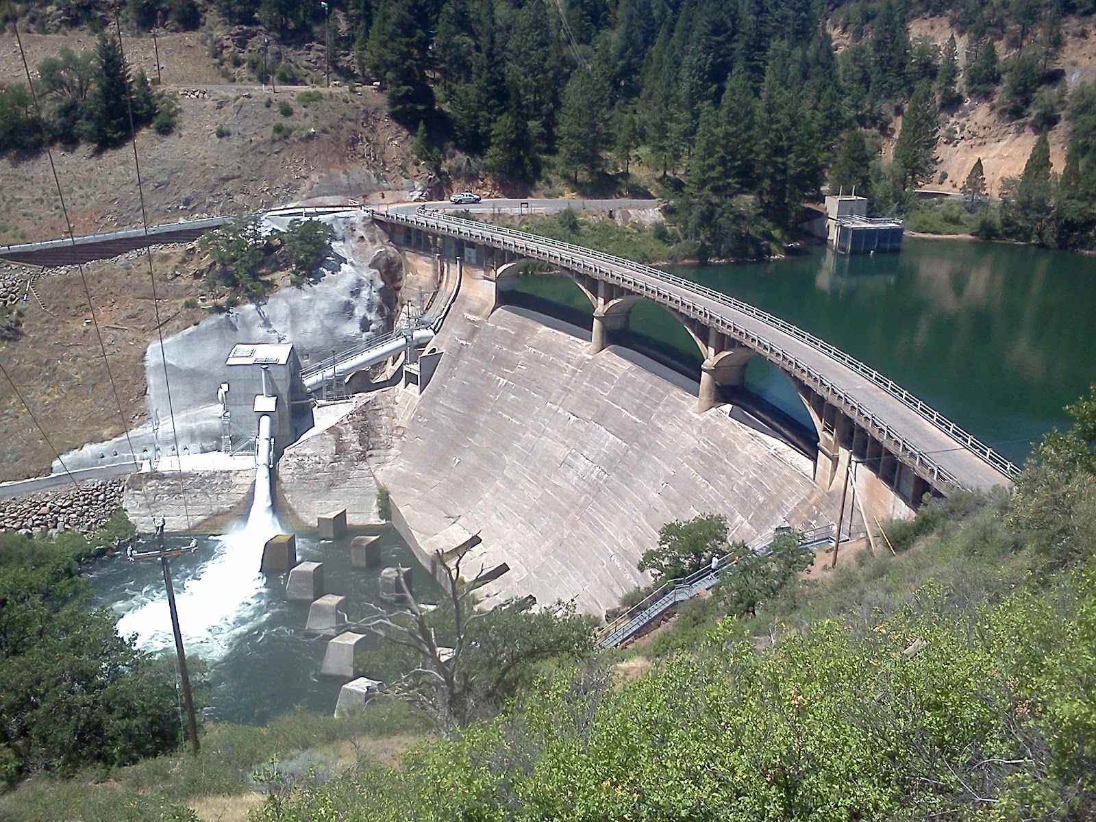
Lake Britton Dam on Pit River.

Footbridge over Rock Creek, Shasta-Trinity National Forest.
7/12/2012, Crystal Lake Hatchery, mile 1,412.0, 28 miles traveled.
After a nice nero in Burney, Sarah dropped me back at the Hat Creek Rim Overlook at 7:20 am. I was provisioned for five days, intending to next meet Sarah at Castle Crags State Park. The rim walk soon became intensely hot as the sun rose higher. There was no shade on the trail and no cool wind to offer relief. After about 15 miles, I came upon a water cache and gratefully replenished my supplies. I enjoyed a brief visit with Rattlebee, Dayhiker, Halfpoint, and Crow, and then continued walking. A wind developed in the afternoon but it felt like a furnace blast. The tread was lava, mostly covered by a thin layer of dirt. It was like a frying pan and chunks began to fall off of the soles of my shoes. I called Sarah and begged her to bring me the shoes I had used in Southern California. She graciously agreed to drive all the way back from Gardnerville, Nevada and meet me at the Crystal Lake Hatchery with the shoes that evening. Finally, the trail dropped off of the rim, crossed bare lava, and entered a flat, grassy area that looked like an African savanna. It was a tremendous relief to reach the hatchery with its shady green lawn, picnic table, and restroom. I enjoyed eating dinner with Sarah and most of the folks I had met at the cache. A resourceful osprey provided the evening’s entertainment by repeatedly stealing trout from the hatchery. I was kind of glad my shoes had fallen apart. It allowed me to be with Sarah on our 25th anniversary.

Lavender mariposa lily.

Looking back along Hat Creek Rim toward Mt. Lassen.

Looking north along Hat Creek Rim toward Mt. Shasta.

Crossing lava.

Crossing savanna between Hat Creek Rim and Burney Falls.
No comments:
Post a Comment