Northern Oregon: Willamette Pass to the Columbia River
8/17/2012, Cascade Locks,
mile 2,155.0, 15.5 miles traveled.
I felt better in the morning. I enjoyed a beautiful, cool morning as I
walked past the many waterfalls on Eagle Creek.
I was amazed at the number of people I saw camping and day hiking
there. I took the bike path from the
Eagle Creek trail head back to the official PCT at Cascade Locks. There, I was happy to meet my parents and
take a precious zero day.

Waterfall on Eagle Creek, Mark O Hatfield Wilderness.

Brink of waterfall on Eagle Creek.

Exposed section of trail on Eagle Creek.

Tunnel Falls on tributary of Eagle Creek.

Narrows on Eagle Creek,
Mark O Hatfield Wilderness.

Falls on tributary of Eagle Creek, Mark O Hatfield
Wilderness.

Lower
Punch Bowl
Falls, Eagle Creek, Mark
O Hatfield Wilderness.

Wauna Falls, Eagle Creek, Mark O Hatfield Wilderness.
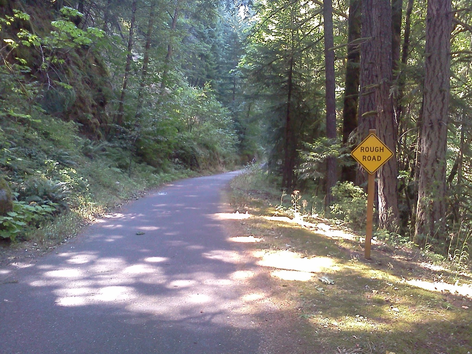
Bike path from Eagle Creek Trailhead to Cascade Locks with
warning.
8/16/2012, Eagle
Creek Trail, mile 2,139.5 23.0 miles traveled.
After a climb out of the Sandy
River Canyon,
the trail stuck to the ridge tops as it skirted the Bull Run Watershed and
headed towards the Columbia River. I’m glad the trail was easy because I felt
pretty bad. It was either the Giardiasis
or the medicine I took for it. I took
the alternate route off the PCT to Eagle Creek.
The scenery is better. It would
have been designated as the official route except that it wasn’t suitable for
horses. When I made camp, it was hot,
humid, and dead calm. I skipped dinner
due to a lack of appetite.

Devils Club, and natural footbridge over Muddy Fork Sandy River.

Spider at mouth level across trail.

Mt. Hood, 11,239 ft., from near Lolo Pass.

Fungus on log.
8/15/2012, Ramona
Falls, mile 2,116.5, 22.0 miles traveled.
Today my stomach started hurting. I felt bloated and had occasional stabbing
pains in my gut. I kept thinking of
another thru-hiker who had similar symptoms and was diagnosed with
giardiasis. I decided to start a seven-day course of metronidazole which I had brought just in case.
I didn’t want to wait for the symptoms to worsen. I picked up a package with 2 days of food at
Timberline Lodge. I skipped the buffet
because I didn’t have an appetite. I
enjoyed hiking on the Timberline Trail that circles Mt.
Hood. It was the trail my father took me
on for my first backpacking trip. I had
a nice visit with Andrew as we dropped into the Sandy River
Canyon. I camped near Ramona Falls. It was in a dark ravine that reminded me of
hollows in the Appalachians.

Mt.
Hood, 11,239 ft., from
near Buzzard Point.

One of hundreds of webs across trail.

Mt. Hood, 11,239 ft., and White
River from near Pucci Glade.

Mt. Hood, 11,239 ft., from rim of Zigzag Canyon.

Mt. Hood, 11,239 ft., from rim of Zigzag Canyon.

Ramona Falls, Mt.
Hood National
Forest.
8/14/2012, Near
Highway 26, mile 2,094.5, 28.5 miles traveled.
I felt like I was coming home today. I crossed Warm Springs Creek and then the Clackamas River.
It was strange to connect the two by foot. They seemed worlds apart when traveling by
car. I got phone reception near Timothy Lake and enjoyed talking with
Sarah. I also called my parents to
arrange our meeting in Cascade Locks. I
was really looking forward to a rest and visit with them. During the evening, I enjoyed views of Mt. Hood
from the Wapinitia
Pass area. I made camp at dusk, and fell asleep to the
sounds of nighthawks. Their wings make a
loud buzzing sound when they dive for insects.

Bridge over Warm
Springs River,
Warm Springs Indian Reservation.

Timothy Lake, Mt.
Hood National
Forest.

North
Arm Timothy
Lake.

Mt. Hood, 11,239 ft., from near Wapinitia Pass.
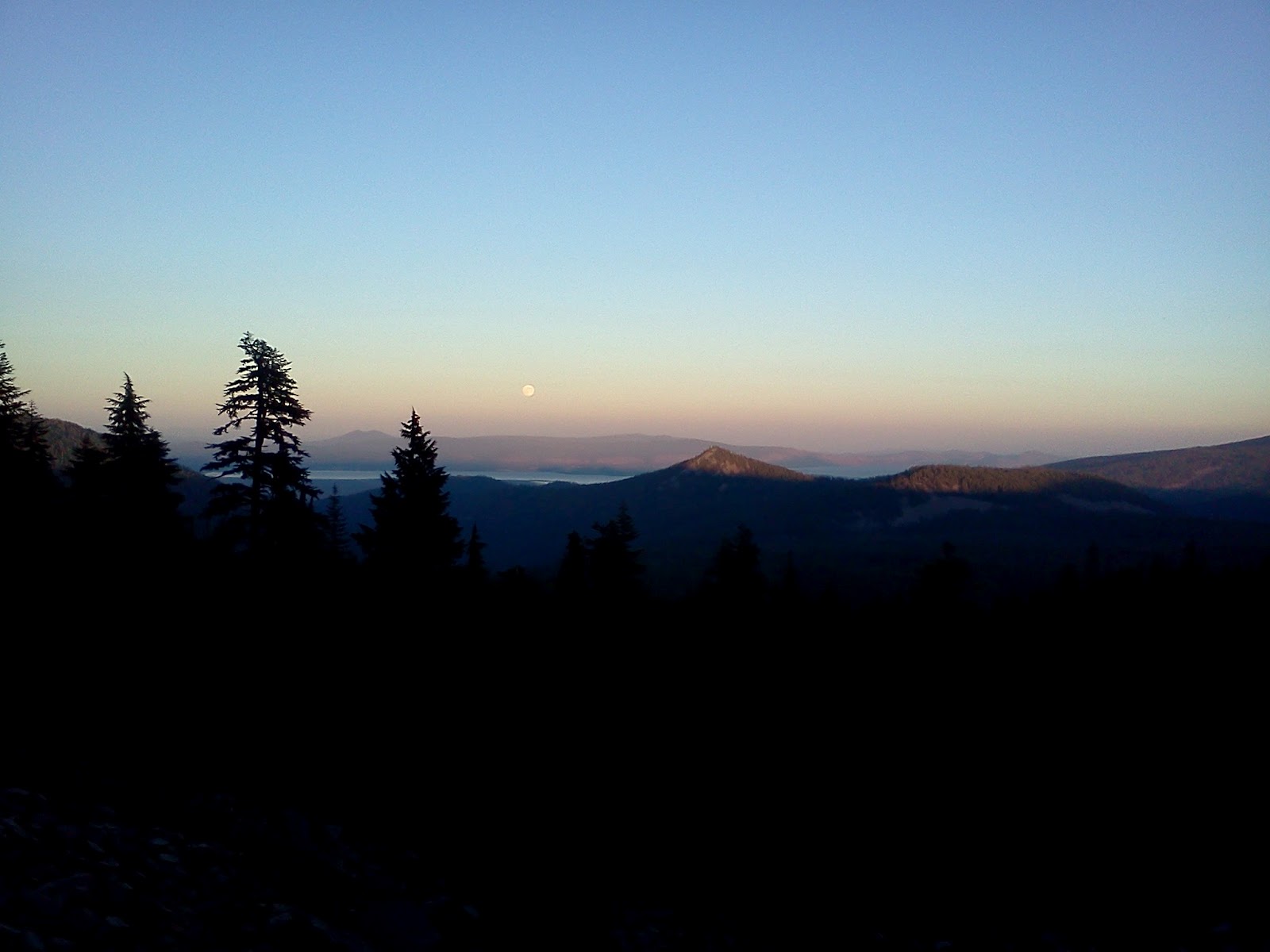
8/13/2012, South
Pinhead Butte, mile 2,066.0, 26.5 miles traveled.
I enjoyed a quiet morning crossing beautiful Jefferson Park.
I climbed Park Ridge,
and noticed a fire to the northeast which looked like it could reach the
PCT. It would result in a temporary
trail closure a few days later. Snow
fields obscured the trail on the north face of Park Ridge.
I eventually found my way past them with the help of my map and
GPS. As I descended towards Breitenbush
Road, I met dozens of search and rescue personnel headed back up towards
Jefferson Park They showed me a picture
of the lost man, a diabetic who was 5 days overdue. They asked me to keep an eye out for him as I
continued north. As the day progressed,
I noticed the smoke from the fire behind me getting larger and larger. The day was hot, but I was able to stay cool
by soaking my shirt in water whenever I passed a creek. In the evening, I picked a handful of
huckleberries. When I looked up, there
was a fat black bear standing about 50 feet up the trail. He quickly dropped to all fours and bounced
away. I made camp on the Warm Springs
Reservation in a logged area. I was
impressed at the way they had left several trees standing and cleaned up the
slash. I wish all the private forests in
California
were managed that well.

Mt. Jefferson from Jefferson Park.

Park Butte, 6,851 ft., Mt. Jefferson
Wilderness.

Smoke from Water Fall 2 Fire on northeastern flank of Mt. Jefferson
from near Park Butte.

Waterfall 2 Fire from near Olallie Lake. Fire would result in 10 mile PCT closure a
few days later.
8/12/2012, Whitewater
Creek, mile 2,039.5, 26.0 miles traveled.
The scenery today was dominated by Mt. Jefferson. One damp section of trail was covered with
little frogs. They were about 1-inch
long and had narrow yellow lines down their backs. They would start hoping around as I
approached. It was difficult to avoid
stepping on them. The mosquitoes weren’t
too bad. There were lots of spider webs
across the trail though. I met another
through hiker, Andrew, who informed me that a search was in progress for a lost
hiker in the Jefferson Park Area. Toward
the end of the day, I was amazed at how steep the landscape was around Russell Creek.
I hoped that the lost hiker hadn’t strayed into that area.

North face of Three Fingered Jack, 7,841 ft., Mt. Jefferson
Wilderness.

South Cinder Peak,
6,746 ft., Mt. Jefferson Wilderness.

Mt.
Jefferson, 10,497 ft.

Mt.
Jefferson, 10,497 ft.,
from Milk Creek.
8/11/2012, Three
Fingered Jack, mile 2,013.5, 25.0 miles traveled.
I was glad to cross the lava field north of McKenzie Pass during the cool of the morning.
Even so, the heat eventually caught up to me and it was with great relief that
I reached a small lake where I washed my feet and socks. It didn’t take long for the fine, volcanic dust
to permeate my socks and feet again though.
I enjoyed talking with a father and son on a south-bound section. Later in the day, I crossed the busy highway at Santiam Pass and climbed to above 7,000 feet on
the southwest face of Three Fingered Jack.
The mosquitoes were fierce there, so I set up my tent quickly and dove
inside.

Looking south at North and Middle Sisters from Belknap Crater, Mt.
Washington Wilderness.

Mt. Washington, 7,794 ft, Mt. Washington
Wilderness.

2,000 mile mark for PCT north-bounders.

Three Fingered Jack, 7,841 ft., Mt. Jefferson
Wilderness.
8/10/2012, Junction
with Lava Campground trail, mile 1,988.5, 25.0 miles traveled.
This was one of the most scenic days of my hike so far. I enjoyed views of the Sisters from a large
meadow called Wickiup Plain where Native Americans used to gather for
ceremonies. The landscape became more
and more colorful and strange around Opie
Dilldock Pass,
with red and black cinder cones and bizarre lava fields. I met several Boy
Scout groups out for long hikes. They
all seemed to be having fun. The
mosquitoes, which had been bothersome during the previous two days, seemed to
disappear after I reached the lava. What
a relief!

View of fog over Elk
Lake from Koosah Mountain.

South Sister, 10,358 ft., from Wickiup Plain, Three Sisters
Wilderness, Willamette
National Forest.

Lupines, Three Sisters Wilderness.

Middle Sister, 10,047 ft., Three Sisters Wilderness.

The Husband, 7,624 ft., Three Sisters Wilderness.

North Sister, 10,085 ft., Three Sisters Wilderness.

Collier Cone, 7,583 ft., Three Sisters Wilderness.

North Sister from Opie
Dilldock Pass,
Three Sisters Wilderness.

Yapoah Crater, 6,737 ft., Three Sisters Wilderness.

Belknap Crater, 6,872 ft., Mt. Washington,
7,794 ft., Three Fingered Jack, 7,841 ft., and Mt. Jefferson, 10,497 ft. from
Yapoah Crater, Three Sisters Wilderness.

Yapoah Crater, Three Sisters Wilderness.
8/9/2012, Past Elk
Lake, mile 1,963.5, 25.0 miles traveled.
The trail stayed in deep forest throughout the day. I passed several ponds and small lakes, but
none that seemed worth photographing. I
met Asabout coming the other way. I had
met him several times along the trail because he was doing sections southbound
while his wife camped nearby in their RV.
Asabout was moving fast, trying to stay ahead of a couple of
horses. He told me it was his last night
on the trail before he had to return to work.
I was sorry to hear a few days later that he passed away in his tent
that night. My deepest sympathies to his
wife, family, and friends. I picked up a
package with 6 days worth of food at Elk
Lake. It would get me to my next drop 150 miles
away at Timberline Lodge.
8/8/2012, Brahma
Lake, mile 1,938.5, 24.5 miles traveled.
Sarah and I said our sad farewells after a couple of restful
days in Oakridge. She dropped me off at
the Willamette trail head at 9:00 am on her way home to Nevada.
I really appreciate her companionship and assistance during the
summer. The trail today was
predominantly through forest with a few lakes and ponds. I saw a couple of other thru-hikers, Robin
Hood and Bladder Pillow. I reached Brahma Lake
at 8:20 pm. They and a couple others
were already asleep.

Lower
Rosary Lake
and Pulpit Rock, 6,384 ft.

Charlton Lake, Willamette
National Forest.