Southern Oregon: Ashland to Willamette
Pass.
8/5/2012, Willamette
Pass, mile 1,914.0, 37.0 miles traveled.
We hiked together for six miles until we reached the car at Windigo Pass.
Sarah drove to Willamette
Pass and began hiking
back towards me at 2:00 pm. I ascended
1,200 feet to the west shoulder of Cowhorn
Mountain. From there, I could see Odell Lake
in the north. I then descended for seven
miles and took a break on the west shore of beautiful Summit Lake. The next seven miles took me up the southeast
side of Diamond Peak.
A thunderstorm developed just as the trail emerged onto open
snowfields. I hurried across the large
cirque on the southeast shoulder of Diamond
Peak, and met Sarah
shortly after the downpour started. We
decided to make a run for the car, even though it was seven miles away and it
was 7:00 pm. The thunder and lightening
gradually abated as we scuttled down the northwest side of Diamond Peak. Darkness caught us long before we reached the
car at 11:00 pm. Sarah had hiked 20
miles by then, and I had hiked 37. We
then drove to Oakridge, and collapsed in a motel.

Monument near Windigo
Pass (Sarah).

Resupplying from car at Windigo Pass
(Sarah).

Cowhorn Mountain, 7,664 ft., from the south, Umpqua National
Forest.

Odell Lake, Willamette
National Forest, from north shoulder
of Cowhorn Mountain,
Umpqua National Forest.

Sawtooth Mountain, 7,301 ft., Willamette and Umpqua National
Forests.

Summit Lake, Willamette
National Forest.

Summit Lake, Willamette
National Forest.

One of many ponds and lakes in the Diamond Peak Wilderness, Willamette National Forest.

Looking south as storm brews over Summit
Lake, Willamette National Forest.

Snow covers PCT in cirque on Diamond
Peak, 8,744 ft., Diamond Peak
Wilderness, Willamette
National Forest.
8/4/2012, Tolo Camp,
mile 1,877.0, 28.5 miles traveled.
Sarah and I parted.
She hiked back to the car, while I continued north. I had to step over many blow-downs (fallen
trees) until I crossed the north boundary of Crater Lake National Park. I enjoyed rare views as I crossed the west
shoulder of Mt. Thielsen. Diamond
Lake looked especially
inviting because water was scarce on this section of trail. I crossed small snow patches on the north
side of Thielsen, and collected water from Thielsen Creek. After more forest, I emerged at a saddle by Tipsoo Peak
which was the highest point (7,560 ft.) on the trail in Oregon
and Washington. The day was warm and muggy, and the
mosquitoes were bothersome. I met Sarah in
the late afternoon, and we hiked until dusk to a nice campsite near Six Horse
Springs. We felt very fortunate to have
the shelter of our bug-free tent.

Mt. Thielsen, 9,182 ft., and Hollys Ridge
from the south, Mt. Thielsen Wilderness, Freemont – Winema National Forests.

Diamond Lake, Umpqua
National Forest.

Mt.
Thielsen, 9,182 ft., from
near its west shoulder, Mt. Thielsen Wilderness, Freemont – Winema National
Forests.

Mt.
Thielsen, 9,182 ft., from
Thielsen Creek, Mt. Thielsen Wilderness,
Freemont – Winema National Forests.

Sawtooth Ridge, Mt.
Thielsen Wilderness,
Freemont – Winema National Forests.

Tipsoo Peak, 8,034 feet, from highest point along Oregon and Washington
PCT, 7,560 ft. .

Miller Lake, Fremont
– Winema National Forests.

Old PCT marker near Windigo Pass,
Umpqua National Forests (Sarah).
8/3/2012, Near Timber
Crater, mile 1,848.5, 20.5 miles traveled.
The morning was very cool, about 58˚F. Sarah and I walked to Highway 62, where she
had parked the day before. She drove to
the north end of Crater Lake and began hiking
back towards me, while I began the ascent to the lake’s rim. As the day warmed, the mosquitoes became
fierce. There were so many of them
around my head, I had to be careful not to inhale them. Fortunately, the mosquitoes disappeared when
I reached the rim of Crater Lake. The views were breath-taking as I followed
the trail around the western rim. I took
a short side trip up to a lookout on The Watchman, where I could see from Mt. Shasta
in the south to the South Sister in the north.
Unfortunately, even though I had texted Sarah, she didn’t have
reception, and passed by the side trail on her way south. I met my parents at a parking lot below The
Watchman (by luck). They found Sarah,
while I finished the hike on the rim and reached the car. We then enjoyed a wonderful picnic back near
the historic lodge in Rim
Village. Sarah then dropped me back at the north side
of the lake and drove north to the Grouse Hill trailhead. We met up in the evening and continued hiking
north through flat pumice fields chocked with stunted pine trees. At dusk, we startled several elk. I didn’t get a good look at them, but they
were very large and had tan rumps.

Crater Lake from Rim
Village, Crater Lake National Park.

Wizard Island from near Discover Point, Crater Lake National Park

Llao Rock, 8,049 ft., Crater Lake National Park.

Lookout tower on The Watchman, 8,013 ft., Crater Lake National Park.

Looking south from Devils Backbone, Crater Lake National Park.
8/2/2012, Past Union
Peak Trail junction, mile 1,828.0, 25.0 miles traveled.
I spent the morning in thick forest, but enjoyed spectacular
views from the shoulder of Devils
Peak in the early
afternoon. As I looked northwards, it
took me awhile to realize that the distant peaks were actually the rim of Crater Lake. The
day turned hot as I continued through a large burn and then crossed the Oregon Desert
(area with pumice soil). I was happy to
meet Sarah in the late afternoon. We
caught up on each other’s news, ate a dinner she had packed in, and eventually
camped in a flat forested area.

Devils Peak, 7,682 ft., Sky Lakes
Wilderness.

Looking southeast toward Klamath
Lake from shoulder of Devils Peak.

Looking south toward Mt.
McLoughlin from shoulder of Devils Peak.

Looking north toward rim of Crater Lake from shoulder of Devils Peak.

Lupines, Rogue River – Siskiyou National Forest
(Sarah).
8/1/2012, Divide
Trail junction, mile 1,803.0, 26.5 miles traveled.
Sarah and I enjoyed views of Mt. McLoughlin
as we finished hiking across the lava fields in the morning shade. We met a south-bound thru-hiker named
Beads. She hiked with a German shepherd
named Rock Star. She put booties on him
whenever they crossed lava. We reached
the Highway 140 trailhead, where Sarah had parked the day before, at about
10:00 am. I gathered food for the next 2
days. Sarah spent the rest of the day
mailing food packages ahead for me (I’m so lucky!), and spent the night with my
parents in Talent. The trail offered
only a few glimpses of nearby peaks and lakes as it continued through the
forest. At the end of the day, I reached
a steep, rocky ridge where I could finally see out. I found a small flat spot in a saddle to camp
on. I could hear the wind rushing
through a cleft a few hundred yards away, but it was calm where I camped. I enjoyed watching a full moon rise over
distant Klamath Lake.

Mt. McLoughlin, 9,495 ft., Sky Lakes, Wilderness, Rogue
River – Siskiyou National Forest (Sarah).

Crossing lava beds on Brown
Mountain, Rogue River – Siskiyou National Forest.

Jay meets south-bound thru-hiker, Beads, and companion, Rock
Star (Sarah).

Fourmile Lake, Sky Lakes Wilderness, Fremont – Winema National Forests.
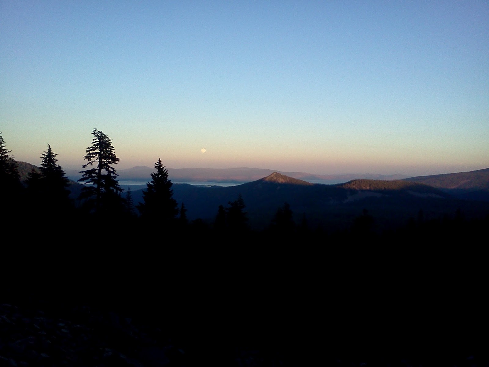
Full moon rising over Klamath Lake.
7/31/2012, Near Brown
Mountain, mile 1,776.5, 25.0 miles traveled.
Conditions were perfect for hiking again today: cool with
hardly any mosquitoes. The trail made a
gentle, 7-mile ascent and remained fairly level for the rest of the day. Again, there were no clear views from the
forested trailside. I visited one of the
only shelters on the PCT (South Brown Mountain Shelter), but it was too early
in the day to stop there. I met Sarah in
the late afternoon, and we found a slanted tent spot amongst the lava fields on
Brown Mountain.

South
Brown Mountain
Shelter.

Imported cinder tread across lava fields on Brown Mountain,
Rogue River – Siskiyou
National Forest.

Hollow log with spokes (Sarah).
7/30/2012, Hyatt Lake
Recreation Area, mile 1,751.5, 25.0 miles traveled.
After a wonderful sojourn with my parents in Talent, Oregon, Sarah dropped me
off at the Interstate-5 trailhead at 7:30 am.
The PCT meandered eastward to Pilot Rock, and then slowly turned
north. There were lots of little ups and
downs and very few views as the trail stayed in thick forests. I heard two ravens quarreling in a fir
tree. Out of nowhere, a hawk swooped in
and swung its outstretched talons towards one of them. The quarry flew from his perch just in the
nick of time. I met Sarah at 4:00 pm as
she was talking with a young trail crew just finishing their day of removing
star thistles from a quarter acre area by the trail. They informed us that a natural predator moth
would be introduced next year to hopefully finish the job.

Blossom near Hyatt Reservoir (Sarah).

NYC crew removing star thistle from PCT trailside near Green Springs
Mountain (Sarah).
No comments:
Post a Comment